Map - Sanarate (Municipio de Sanarate)

Sanarate (Municipio de Sanarate)
Sanarate is a city, with a population of 20,976 (2018 census), making it the second largest city in the El Progreso department of Guatemala, after the departmental capital of Guastatoya. It is the administrative seat of Sanarate Municipality.

The municipality of Sanarate is formed by the town of Sanarate and 43 aldeas (villages). Some of the most popular are El Upayon, Agua Salobrega, Los Izotes and El Monte Grande. El Barranquillo is one of the many villages that belong to Sanarate. El Barranquillo celebrates its "virgen de Fatima festivities" from October 28 through November 1 or 2. Its festivities enlarge due to a national holiday called "el dia de los santos". Soccer games, food, mechanical games all await the visitor during these festivities.

 
Map - Sanarate (Municipio de Sanarate)
Map
Google Earth - Map - Sanarate
Google Earth
Openstreetmap - Map - Sanarate
Openstreetmap
Map - Sanarate - Esri.WorldImagery
Esri.WorldImagery
Map - Sanarate - Esri.WorldStreetMap
Esri.WorldStreetMap
Map - Sanarate - OpenStreetMap.Mapnik
OpenStreetMap.Mapnik
Map - Sanarate - OpenStreetMap.HOT
OpenStreetMap.HOT
Map - Sanarate - OpenTopoMap
OpenTopoMap
Map - Sanarate - CartoDB.Positron
CartoDB.Positron
Map - Sanarate - CartoDB.Voyager
CartoDB.Voyager
Map - Sanarate - OpenMapSurfer.Roads
OpenMapSurfer.Roads
Map - Sanarate - Esri.WorldTopoMap
Esri.WorldTopoMap
Map - Sanarate - Stamen.TonerLite
Stamen.TonerLite
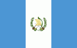
Country - Guatemala
Currency / Language  
ISO Currency Symbol Significant figures
GTQ Guatemalan quetzal Q 2
ISO Language
ES Spanish language
Neighbourhood - Country  
  •  Belize 
  •  El Salvador 
  •  Honduras 
  •  Mexico 
Administrative Subdivision
City, Village,...